Prediction
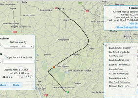
The HabHub Predictor website can be used to predict where the balloon is possibly going to land.
You need to enter the folowing informations to compute the prediction:
- Latitude
- Longitude
- Time
- Ascent rate
- Burst altitude
- Descent rate
The prediction is displayed on the map, then it’s possible to download the prediction as multiple formats including KML at the top right corner.
KML files can be used with Google Earth
which is not Open Source but is running fine on Gnu/Linux.
There is also another tool from the Cambridge University Space Flight which is called the Hourly Predictor.
Code source of these tools are available and I installed the hourly
predictor on my Raspberry Pi server, but this will be the topic of a
separate post.
The prediction tool use wind data from NOAA / National and Oceanic Athomospheric Administration
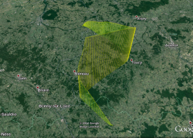
Screenshots of the prediction, 1 hour before the flight:
Flight data
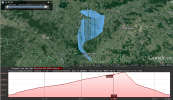
All flight data has been recorded by the Raspberry Pi inside the payload
in NMEA.
To use it in Google Earth, we can convert it to KML to keep the ability
to view altitude information and see lines from the ground, using open
source gpsbabel tool.
gpsbabel -i nmea -f gps_data.nmea -o kml,floating=1,extrude=1 -F out.kml
Tip: you can get the KML of a flight from Habitat server
here
Then you can directly paste the resulting URL of the KML, into the
“Search” form.. the flight track will be automatically loaded on the
map.
It currenlty works for KML files under 10MB. My Flight data from the
payload is bigger so I used here the .kml of the flight data that has
been uploaded to Habitat server.
Prediction accuracy
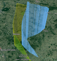
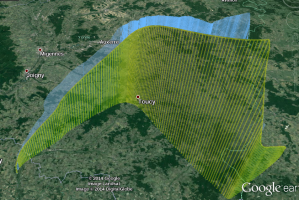
I took a screenshot of the flight prediction several days before the flight. Here is the result:
For the prediction to be the most accurate, it is necessarry to carefully measure all weights, helium quantity etc… the day of the flight.
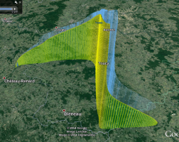
The prediction is in yellow, and the flight in blue:
Comparing the prediction (even few days before) and the real flight, we
can conclude that the prediction tool and NOAA data are very accurate.
According to UKHAS members, this is quite common to have this kind
of accuracy.
The “shape” of the fight is very similar and the landing point was only 6 Km away from the prediction… Impressive :)
As we know the prediction is usualy accurate, this give us the opportunity to postpone a launch that would have been landed too far away, too close from a city, an highway, some river etc..
I need to investigate more on
OpenStreetMap capabilities to deal with
KML and see if it can be used instead of GoogleMaps.
Great job done by UKHAS people managing HABHub and those from Cambridge University Space Flight who created the software who is able of such accurate predictions.
